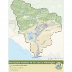
Descripción General de la Cuenca Hidrológica
For the benefit of the many Spanish speakers in the watershed, we’ve started translating some of our materials into Spanish. A Spanish version of our Watershed Overview map has been added to our Map Atlas, and the Watershed Council’s Mission Statement (Misión), and our watershed management plan’s Goals and Objectives (Metas y Objectivos) have been translated into Spanish.
We hope to be able to offer more Spanish language materials in the future (like this announcement!). Please consider forwarding this information to audiences whom you think may find it useful.
Reminder: July 11 Watershed Council Meeting
The Ventura River Watershed Council will meet on Thursday, July 11, 2013, from 9:00 – 11:30 am, in the Topping Room of the EP Foster Library, 651 E. Main St., Ventura.
At the meeting, we’ll get updates on a variety of topics including the State Water Board’s development of biological objectives, the Biodigester Feasibility Study Final Report, the city of Ventura’s recent 2013 Comprehensive Water Resources Report, the recent WEAP Model training, the work of the new Horse & Livestock Watershed Alliance, and the activities of Watershed Coalitions of Ventura County.
Here is the agenda.
Updated Flood Maps in the Ojai Valley
May Decrease the Number of High Risk Properties
Here is a link to a recent article originally from the Ventura County Star about potential changes to flood zone boundaries for the alluvial fan areas on the east end of Ojai, which could change which properties are subject to flood insurance requirements. The new flood maps have not yet been approved by FEMA and are subject to changes during the public outreach process, which is likely begin in August. The final approved maps would become official in mid-2014 after the FEMA public notification process and any revisions are completed.
New FEMA Study on the Effects of Climate Change
on the National Flood Insurance Program
The Federal Emergency Management Agency (FEMA) recently completed a study begun in 2008 looking at the effects of climate change and population growth on the National Flood Insurance Program (NFIP). FEMA’s analysis found that over the next 90 years, there will likely be a significant increase in coastal and riverine flooding in our nation, which will have a significant impact on the NFIP. The study is discussed in this Natural Resources Defence Council article, which includes a link to the actual FEMA report.
New Nature Conservancy Report Uses Ventura County as a Case Study
on the Use of Planning Tools to Address Climate Change and Coastal Resilience
To help coastal communities prepare for rising sea levels, The Nature Conservancy analyzed the current city and county planning policies in southern California, using Ventura County as a case study, cataloguing the strategies and methods that could be used to address sea level rise planning and permitting processes throughout coastal California. Here is a link to a brief on that report.